|
Photo Album Maps & Atlases >
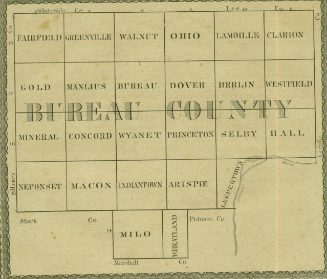
Bureau County Map 1867
Bureau County Map 1867
In getting up this map, an effort was made to have it excel in corrections and mechanical work, anything of the kind heretofore published. To accomplish this, neither labor nor money have been spared. Competent men were employed on the surveys, with the understanding that they should have about all the profits. The contract for the mechanical work was let for several hundred dollars more than would have been required for ordinary map work. How well the publisher has succeeded in accomplihing his designs, the public will to decide.
This map makes no pretension to show every particular thing in its proper place - perfection belongs to nothing, much less county maps. If it were possible to get the draft perfect, errors would be made by the engravers, which would not be detected in time for correction.
Source: Maps & Sketches of Bureau County, Ill., By N. Matson 1867
TAMPICO AREA HISTORICAL SOCIETY - MUSEUM - FAMILY HISTORY LIBRARY/RESEARCH CENTER 119 Main St., P. O. Box 154, Tampico, IL 61283 www.tampicohistoricalsociety.com tampicoareahistory@gmail.com We are an all-volunteer organization so your donations are always appreciated! Sign up to receive our e-newsletter. Thank you! Visit us on FACEBOOK.
|